News - 28/05/2015
New satellite images to better support the monitoring of Asia’s rice areas
Information derived from satellite images can soon be made available to governments to help guide policy related to food security and sustainable development, particularly in rice-growing areas.
The European Space Agency (ESA) satellite, Sentinel-1A, launched in 2014 can provide regular ‛snapshots’ of Asia as often as every 12 days. The imagery is derived from synthetic aperture radar (SAR) systems that can monitor the earth’s surface day and night, even through rain or cloud cover, making the tool perfect for agriculture and rice crop monitoring.
sarmap, which is part of the ERMES consortium, and the International Rice Research Institute (IRRI) have generated mosaics, composed from several Sentinel-1A images that cover 7 million square kilometers of South and Southeast Asia. This kind of imagery and monitoring can support a data revolution, leading to better and more timely information on natural resources and crop – included rice – production.
You can find here the whole IRRI article titled “Satellite imagery to soon enable large-scale monitoring of Asia’s rice areas”.
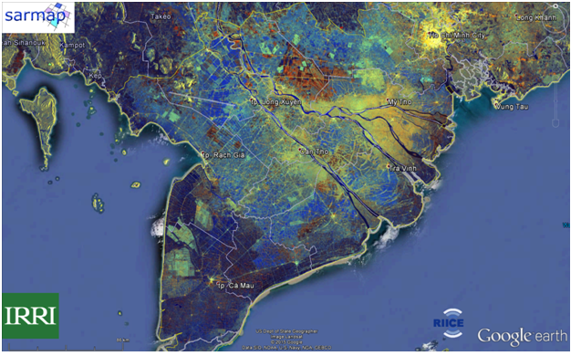
The lower Mekong River Delta, viewed with as a SAR imagery. (SAR imagery from ESA: Sentinel-1A. Background from Google Earth © Google Inc.)