The ERMES Web-based Geoportal allows authorized users to visualize information relevant for rice crop monitoring at regional scale (Regional Rice Service) and for sustainable crop management at local scale (Local Rice Service).
ERMES Geoportal focuses on visualizing and analysing relevant data products (e.g., meteo data, phenology, vegetation index) for wider area and targets e.g. local governments, regulatory agencies or agribusiness companies.
Its prototype application is available at this link and offers a small set of features, and essentially lets users explore and compare data products. For instance, user can visualize ERMES data products, inspect the temporal profile of data products, or compare two data products using a moveable vertical bar.
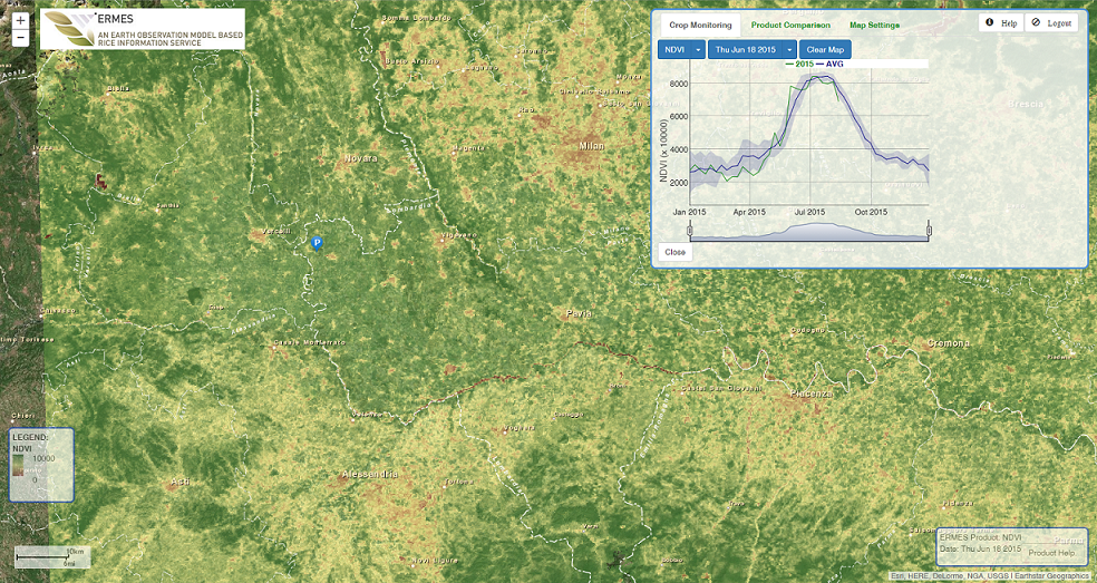
ERMES Geoportal screenshot
At this page you find a short manual that explains the use of the ERMES smart-App and local Geo-portal ( Spanish version) .