ERMES will provide to the private sector (e.g local farmers, agri-business companies or insurance companies) high level information on yield variability, risk alert and crop damage assessment at farm scale. Local end-users will be able to receive, visualize and analyze information related to the various ERMES local-scale products for their own estate within dedicated sections in Ermes geo-portal.
This information is meant to be used by farmers or agri-business companies in
- evaluating inter- and intra-field yield variability (useful in the framework of precision-farming applications and in the development of environmentally sustainable management practices)
- highlighting potential biotic and abiotic risks for rice development in the different fields
- highlighting eventual crop damages.
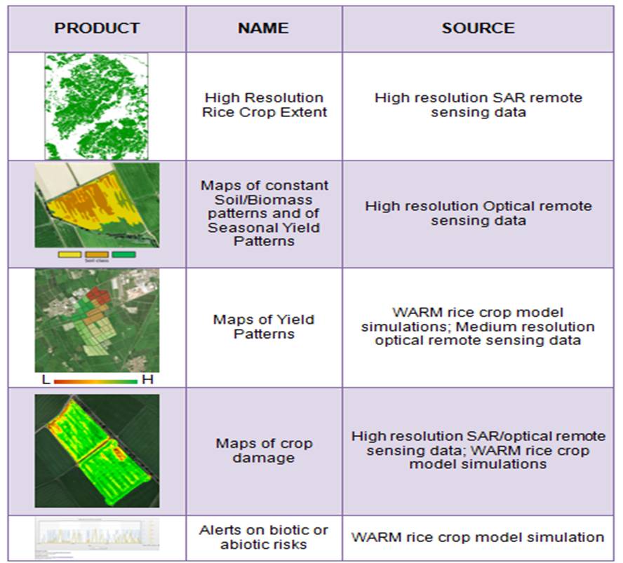
A summary of the main ERMES products that will be available is shown below:
The quality and usefulness of some of these local products, provided for each rice field of interest, will be enhanced by the availability of high quality information directly provided by field operator ( i.e. rice varieties, sowing dates, fertilizations, crop practices, etc.).
To aid the collection of this kind of information, customized Smart Applications for mobile phones and/or tablets will be developed in the framework of the project. These smart-apps will allow farmers and field operators to easily collect the required information and automatically upload it to the ERMES database, and also to send geotagged messages and pictures informing of particular conditions of their fields (e.g., pathogen attacks, presence of pest) to ERMES regional operators.