(English) During the 2016 growing season, ERMES partners in Spain successfully performed a continuous exploitation of the high-resolution (10 m) Sentinel-2 data acquired in the three local study areas in order to derive leaf area index (LAI) maps .
Sentinel-2 LAI maps were obtained inverting the PROSAIL radiative transfer model specifically parameterized for Mediterranean rice cropping systems. Maps were obtained and uploaded regularly to the ERMES geoportal to facility the data to ERMES users. This kind of data is useful for rice crop monitoring and for the recalibration of the WARM rice model.
The Sentinel-2 LAI maps are being directly validated by ground LAI measurements acquired in the field campaigns conducted over each country, and indirectly validated with coarse LAI products such as MODIS and Copernicus Biopar/GEOV1 which are used in the ERMES EP_R3 product. Future news will be posted regarding this activity.
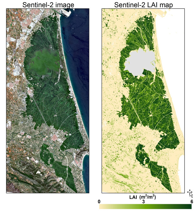
RGB composite (left) and LAI map (right) derived from Sentinel-2 data (10 m resolution) acquired on 2016 August 19 over the Spanish local study area