(English)
In the framework of ERMES 2016, high resolution (20m) maps of rice crop distribution in the regional study area of Greece, Spaoin and Italy were created. This was done by analyzing multitemporal Sentinel 1-A radar images, as well as Sentinel-2A and Landsat 8-OLI data.
The analysis of the “temporal signature” of crop fields allowed to realize very accurate maps, hihglighting the extent and distribution of rice crops.
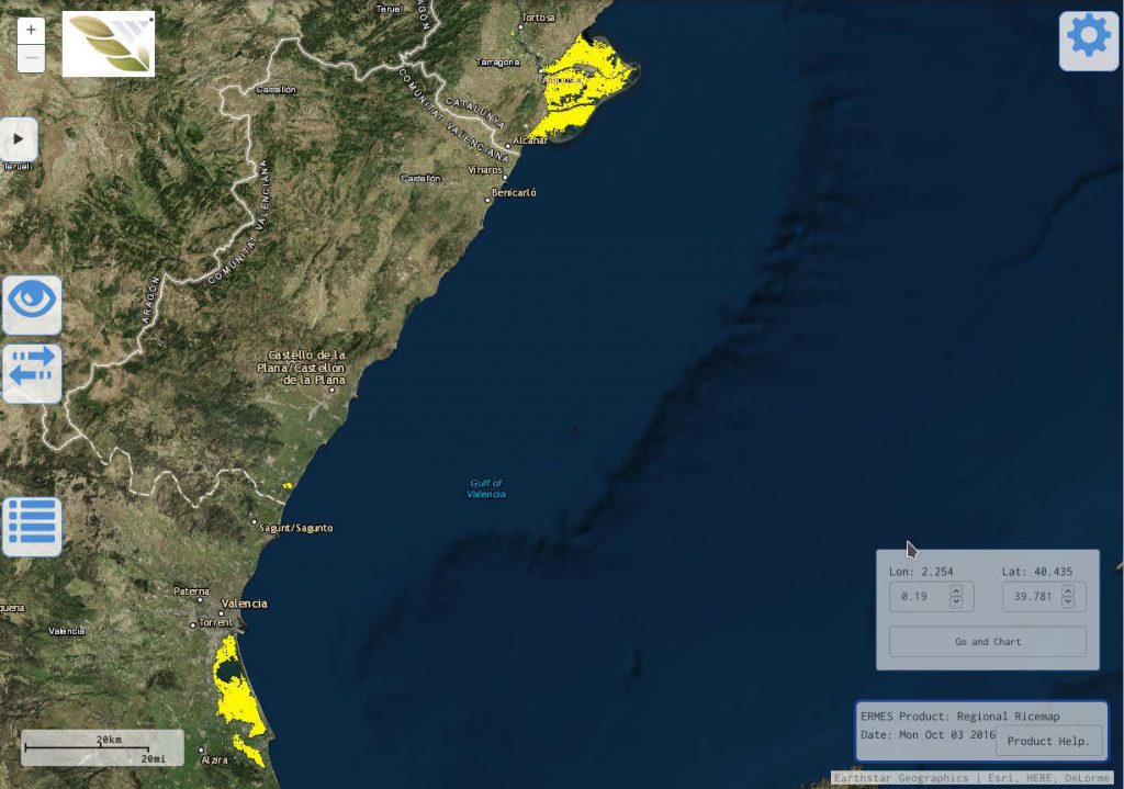
ERMES Spanish 2016 rice map
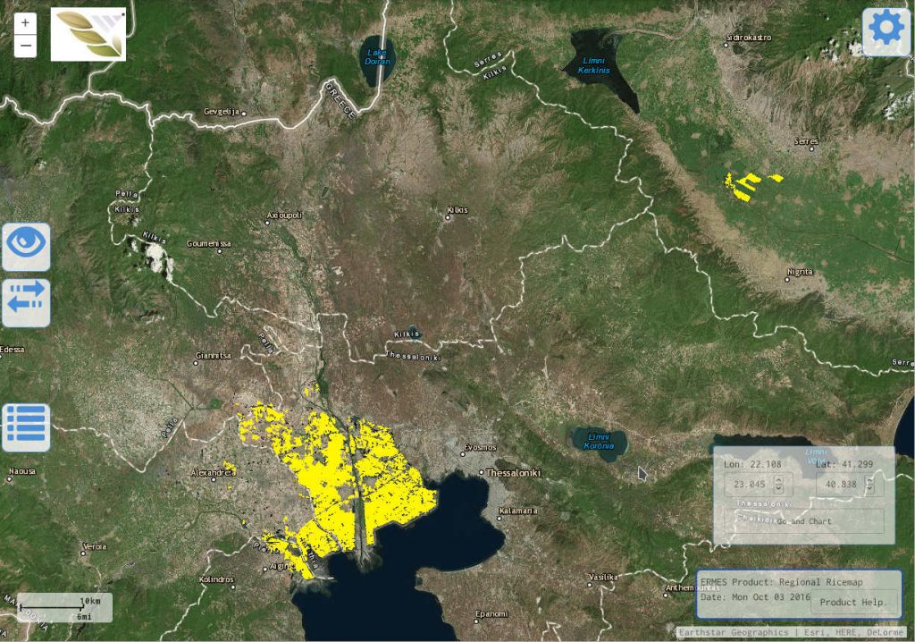
ERMES Greek 2016 rice map
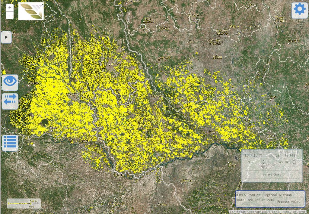
ERMES 2016 Italian rice map