2014 – Rice crop mapping
Rice maps provide information on the extent of the area covered by rice crop cultivations during the on-going season (“early rice area map”, mid-July) and at the end of the season (“end of season rice area map”, mid-October). The first mapping products delivered within the ERMES project have been produced by Sarmap in collaboration with IREA-CNR and AUTH.
The ERMES rice area maps have been produced by processing EO data time series acquired by SAR (Radarsat-2) and/or optical sensors (Landsat OLI) thus delivering products derived from only SAR, only optical and SAR+optical data integration. During the first year of the project (2014) different algorithms have been tested to the aim of:
- assessing the best performing algorithm,
- identify the most suitable approach for each type of data,
- tune algorithms on the specific characteristics of the regional study areas.
The figures below show some examples of the rice area maps derived over two ( Italy and Greece) of the three regional study areas of the project.
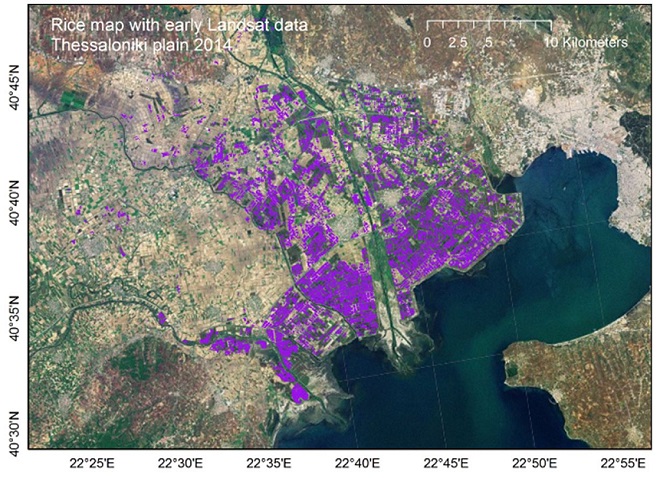
Early rice area map derived from Landsat OLI data over the Thessaloniki plain, Greece, for the year 2014.

End of season rice area map derived from the integration of Radarsat-2 and Landsat OLI data over the rice district in Northern Italy for the year 2014.
The rice area map products are raster maps coded 1 (rice), 0 (no rice) and 255 (masked).
The accuracy of the rice area maps has been assessed by comparison with reference data available from field campaigns carried out in the regional study areas by the project’s partners, databases/statistics available from institutional bodies and expert photo-interpretation of satellite images.