News - 18/08/2014
A smart collection of field data
In the context of ERMES 2014 field activities, measurements of LAI (Leaf Area Index) were collected in mid-August in several paddy rice fields, in concomitance with the acquisition of a high resolution satellite image. This task was carried out by two operator types: CNR-IREA experts and farmers.
In order to obtain a LAI map at high resolution over rice fields in the Rosasco area (Pavia province, Italy) a satellite acquisition was scheduled for the mid-August. This map could be exploited to estimate the rice yield over an area of 150 km2, 1 month before the beginning of harvest.
Field LAI measurements, necessary for the map computation, have been taken using the Smart Application named PocketLAI developed by CASSANDRA (Centre for Advanced Simulation Studies AND Researches on Agroecological modelling, University of Milan) research group. The application allows accurate LAI estimations simply using the smartphone camera and accelerometer, rather than more expensive/ sophisticated devices such as ceptometer, LAI2000 or hemispherical camera.
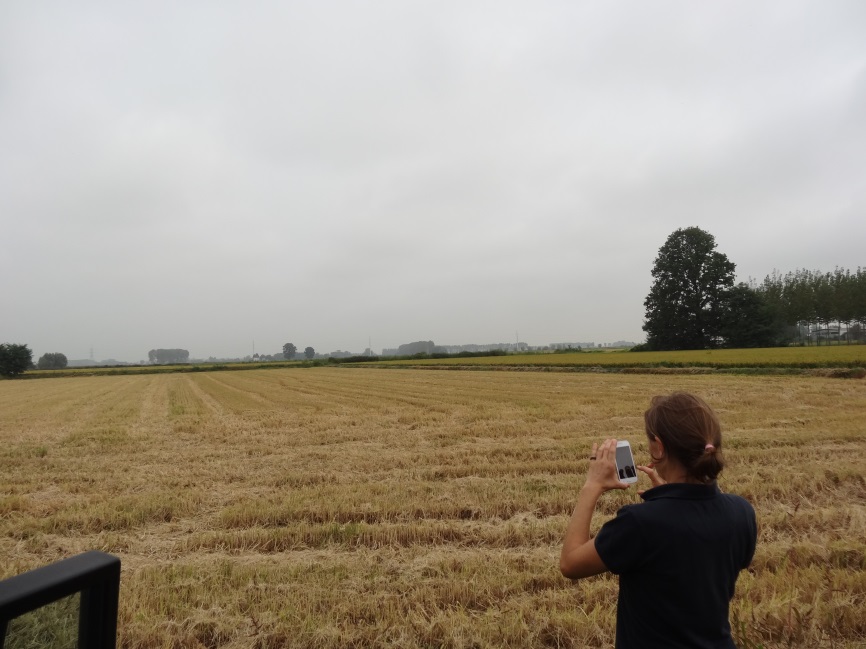
A CNR-IREA operator is setting up the smart application ‘Pocket LAI’. Rosasco (Pavia,IT) August 2014.
Since the app is very easy to be used, the LAI data were autonomously collected by CNR-IREA staff and local farmers,too. The fundamental farmers’ help allowed the researchers to obtain several LAI estimation (about 100) at the same time of satellite overpass, that will be used to compute the LAI map.
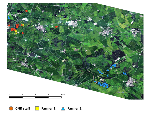
Localization of LAI measurements collected in the italian study area by CNR-IREA staff and local farmers (August 2014)
For further information you can contact Francesco Nutini (CNR-IREA) nutini.f@irea.cnr.it or Roberto Confalonieri (University of Milan): roberto.confalonieri@unimi.it or cassandra.lab@unimi.it